Expanding your personal archive with digitized Sanborn Maps
Sanborn Fire Insurance Maps provide oodles of information for the personal archivist. Recently I tracked down information about my current home, my family history, and my city’s history using Penn State Libraries’ digitized Sanborn maps of Pennsylvania. My interest was personal, but the same methods could be applied to research historical figures or sites. Here’s how I used the maps.
Accessing the maps
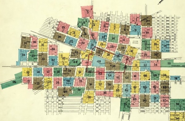
Penn State Maps Library offers free online access to Pennsylvania Sanborn maps up to 1923 (later issues will be forthcoming in 2019 as copyright runs out and they become public domain). Sanborn mapmakers began creating the maps in 1867 for insurance purposes. The maps are very beautiful—they were hand drawn, printed lithographically, and hand colored with bright yellow, pink, blue, and green ink.
The Penn State Sanborn Maps collection covers over 500 cities and towns across the state. To view the maps, click on the city name from the alphabetical list and choose the year you want to see. Many of the city maps have multiple sheets that zoom in on different parts of the city, so you may need to browse until you find the exact location you are seeking. You can also download or print the maps.
In addition, Penn State has shared the maps with the Digital Public Library of America, so you can also access the maps there.
 Your home’s history
If you live in Pennsylvania and your home was built before 1923, you may be able to find it on a Sanborn map. Using the Sanborn key, you can see information about your home’s construction materials, building use, property boundaries, number of stories, water facilities, windows and doors, etc. at the time the map was created.
I tracked down my house, which was built in 1909, and printed and matted the map for display. Visitors often ask about the map, and we usually end up trying to look up their houses, too!
Your family’s history
 Using the maps in conjunction with genealogical records is a way to flesh out your family’s history. You can find the street addresses for family homes, workplaces, schools, churches, and so on. Then you can try to locate that neighborhood in the Sanborn maps collection to add to your personal archive.
For example, I looked up the silk mill where my maternal great-grandparents met. The family legend is that my great-grandmother was working at a sewing machine when my great-grandfather walked past with a skein of silk. Some of the silk got caught in her earring, and the rest is history.
Your city’s history
Several projects compare present-day maps with historical images to track a city’s development over time, for example this one of New York City and this one of Washington, D.C. Using Sanborn maps, you could do something similar with your town. When I studied a Sanborn map of my community, I found to my surprise that my neighborhood used to be an independent city of its own before being incorporated into a neighboring city in the late nineteenth century as the railroad industry grew.
What if you’re looking for a map outside PA?
Consult the Penn State Maps library manager Heather Ross’s library guide for more on Sanborn maps from other states and even select locations outside the United States.
Jessica Showalter is an Information Resources and Services Support Specialist at Penn State Altoona’s Eiche Library. Say hello on Twitter @libraryjms